Napier sits on the gravels and silts of the Heretaunga Plains, where the unconsolidated alluvial deposits can exceed 300 m in thickness before reaching greywacke basement. The 1931 earthquake raised the coastal margin by over two metres, permanently altering the subsurface drainage and compaction history of the area. Seismic tomography gives us a continuous velocity model of these heterogeneous layers, revealing buried channels, paleo-scarps and stiffness contrasts that boreholes alone often miss. Because the water table sits shallow across much of the plains — typically between 1.5 and 3 m depth — P-wave refraction surveys need careful interpretation to separate saturated silt from true rockhead. We combine seismic tomography with MASW profiling when the client needs shear-wave velocity directly for site classification under NZS 1170.5, and we often pair the data with CPT testing to calibrate velocity against tip resistance in the gravelly interbeds common near Taradale.
A seismic tomogram across the Ahuriri estuary showed a buried channel at 18 m depth that conventional borehole interpolation had completely missed.
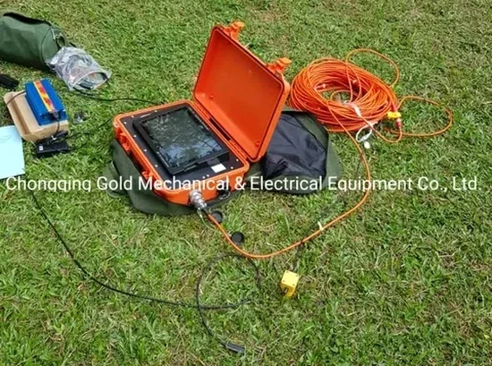
Process overview
On the hill suburbs like Hospital Hill and Bluff Hill, we frequently encounter a thin soil mantle overlying highly fractured Scinde Island limestone, which produces strong velocity contrasts that make refraction picking straightforward but reflection processing trickier. Down on the flat, the alternating sands and clays of the fluvial sequence generate subtle velocity gradients rather than sharp jumps — a classic situation where seismic tomography outperforms conventional refraction interpretation because the tomographic inversion resolves lateral velocity smoothing without forcing a discrete layer model. The field setup uses a 24- or 48-channel seismograph with 4.5 Hz geophones spaced at 2 to 5 m depending on target depth. For reflection work, we typically deploy a weight-drop or accelerated hammer source that delivers a repeatable pulse in the 40-100 Hz band, sufficient to image reflectors within the upper 60 m even with the moderate ambient noise typical of urban Napier. Data processing runs through iterative inversion algorithms that minimise traveltime residuals to below 0.5 ms, and the final P-wave tomogram is then converted to shear-wave velocity using site-specific Poisson ratios derived from downhole logging or published NZGS correlations for Hawke's Bay sediments.
Local context
The seismic risk profile between Napier South and Bay View illustrates why blanket site assumptions fail. Napier South sits on the younger fluvial gravels of the Tutaekuri River fan, where shear-wave velocities in the upper 30 m often exceed 250 m/s and liquefaction susceptibility is moderate. Bay View, by contrast, occupies the coastal margin where saturated estuarine silts and loose dredge fill produce velocities below 180 m/s — a fundamentally different seismic site class under NZS 1170.5. A seismic tomography line across the transition zone can map the lateral pinch-out of the soft layer with metre-scale resolution, giving structural engineers a defensible basis for differentiating foundation design between adjacent lots. Where the tomogram reveals a sharp lateral velocity gradient or an offset in the bedrock reflector, we flag it for follow-up investigation because the 1931 rupture surface is still mapped as active in the NZ Active Faults Database, and blind splays within the basin sediments cannot be ruled out without geophysical imaging.
Questions and answers
What depth of investigation can seismic tomography achieve in Napier soils?
For P-wave refraction tomography with a 120-metre geophone spread, we typically resolve velocity structure to 25-35 m depth in the compacted gravels of the Heretaunga Plains. High-resolution seismic reflection surveys using a 240-metre spread and stacked acquisition can image reflectors at 80-150 m depth, sufficient to map the contact between Quaternary alluvium and the underlying Tertiary or Mesozoic basement. The actual depth depends on the velocity gradient at the site and on the source energy: in saturated silts near the Ahuriri estuary, signal attenuation limits penetration to about 40 m for reflection work.
How long does a seismic tomography survey take in Napier?
A single refraction line with 24 channels and 5-metre geophone spacing — covering roughly 120 m of profile — is typically acquired in 2-3 hours of field time. Processing and interpretation add another 2-3 days. A multi-line reflection survey with CMP stacking can require 1-2 days in the field and a week of processing. We provide a detailed programme during the proposal stage because access constraints in urban Napier — particularly in the narrow streets of the hill suburbs — can extend setup time.
What is the cost of a seismic tomography investigation in Napier?
A single refraction tomography line for a residential or small commercial site in Napier generally falls between NZ$4,520 and NZ$6,800, covering mobilisation, acquisition, processing and a signed geophysical report. A multi-line reflection survey with MASW co-acquisition for a larger development or infrastructure project ranges from NZ$7,200 to NZ$9,440, depending on the total linear metres, the number of shot points and the complexity of the velocity model.
Can seismic tomography detect active faults beneath Napier?
Seismic reflection profiling can image fault offsets in the Quaternary sediments down to a vertical resolution of about 1-2 m, which is sufficient to identify the main 1931 rupture plane and any splays with displacement exceeding that threshold. Refraction tomography complements this by mapping the lateral velocity contrast across fault zones where fractured rock on the upthrown side produces a measurable low-velocity anomaly. Any geophysical indication of faulting is cross-checked against the NZ Active Faults Database and reported with appropriate disclaimers under the NZGS guidelines.
What site constraints affect seismic surveys in the Napier area?
The main constraints are traffic noise along Marine Parade and the state highways, which can degrade the signal-to-noise ratio on reflection records — we mitigate this with higher stacking fold and night-time acquisition where permitted. In the hill suburbs, steep terrain and limited straight-line access restrict the maximum geophone spread length, though we routinely work on slopes up to 25 degrees with sledgehammer sources. The shallow water table across the plains is actually an advantage for P-wave refraction, as it produces a strong velocity contrast at the saturated interface that simplifies interpretation.