← Home · Underground Excavations

Geotechnical Excavation Monitoring in Napier: Instruments That Keep Your Site Safe

Together, we solve the challenges of tomorrow.

LEARN MORE →

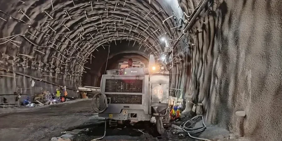
The first thing we install on a Napier excavation site is usually a set of survey prisms mounted on the shoring and the neighbouring buildings, with a robotic total station locked onto them. It might sound simple, but that setup gives us continuous, millimetre-level displacement data, which is absolutely critical in a city where the substrate can change from dense gravels to compressible estuarine silts in less than fifty metres. For deeper cuts near the Ahuriri waterfront or the hill suburbs, we add in-place inclinometers down the face and vibrating wire piezometers at multiple depths to track pore pressure build-up. The monitoring regime here has to account for the legacy of the 1931 earthquake, which lifted the coastline by up to two metres and left a complex stratigraphy of marine terraces and liquefiable layers underneath the CBD. Every reading we take feeds into a trigger action response plan, so if something moves more than the pre-set threshold, the team on the ground knows about it within minutes.

In Napier, the difference between a controlled excavation and a costly incident often comes down to a piezometer reading taken at the right time.

Methodology and scope

Napier’s rebuild after the great 1931 earthquake gave us the Art Deco city we see today, but it also created a unique geotechnical legacy that directly affects how we approach excavation monitoring. The CBD sits on a mix of reclaimed harbour sediments and raised marine gravels, with groundwater tables that respond fast to heavy rain. Over the years, new developments have had to go deeper and closer to heritage structures, which is where the slope-stability analysis ties in, especially when temporary batters are cut in the softer layers. We typically run automated monitoring arrays that log every fifteen minutes, with live dashboards accessible to the structural engineer and the contractor. When you are excavating three storeys down next to a Category 1 listed building, the tolerance for lateral wall deflection is tiny, often less than 15 mm, and the data stream has to be rock solid.
Geotechnical Excavation Monitoring in Napier: Instruments That Keep Your Site Safe
Technical reference image — Napier

Local considerations

Under the New Zealand Geotechnical Society guidelines and the requirements of NZS 4404 for land development, any deep excavation in Napier must have a defensible monitoring plan before the first bucket hits the ground. The reason is straightforward: this city sits in New Zealand’s highest seismic hazard zone, and the silty soils in areas like Pandora and Onekawa are prone to cyclic softening. We have seen excavations where unexpected groundwater migration through old paleochannels triggered movement well outside the predicted zone of influence, and the only thing that prevented structural damage was the real-time tiltmeter and piezometer alert that went off at 2 a.m. Ignoring monitoring here is not a cost saving; it is a gamble with a high-stakes table. The regulatory environment post-Christchurch has tightened significantly, and council consent now routinely conditions monitoring reports at foundation stage.

Need a geotechnical assessment?

Reply within 24h.

Email: [email protected]

Technical parameters

ParameterTypical value
Inclinometer casing depthUp to 40 m below ground level
Survey prism accuracy±1 mm at 100 m range
Vibrating wire piezometer range0–350 kPa, resolution 0.025% FS
Automated logging interval15–60 minutes adjustable
Crack gauge sensitivity0.01 mm
Total station typeRobotic, 1-second angular precision
Trigger threshold (typical)10–25 mm or 5 mm/day rate

Associated technical services

01

Automated Deflection and Vibration Monitoring

Continuous 3D displacement tracking using robotic total stations and triaxial accelerometers. We pre-load heritage building facades with optical targets and run baseline scans before any digging starts. Vibration limits follow DIN 4150-3, adapted to local council consent conditions.

02

Pore Pressure and Groundwater Control Analysis

Multi-level VW piezometer installations with datalogger telemetry, designed to capture perched water in the Ahuriri estuarine sediments. We correlate rainfall data with pore pressure spikes to anticipate dewatering needs and prevent base heave.

Applicable standards

NZS 4404:2010 Land Development and Subdivision Infrastructure, NZS 3404 Parts 1 & 2: Steel Structures (shoring design), NZGS Guideline for Excavation Monitoring, MBIE/NZGS Earthquake Geotechnical Engineering Practice Module 3

Questions and answers

What kind of monitoring does council typically require for a Napier CBD excavation deeper than three metres?

Most consents will ask for a monitoring plan that covers both ground movement and groundwater. That means survey prisms on adjacent buildings and the shoring face, plus piezometers if you are within the known artesian or perched water zones. If the site is within fifty metres of a heritage structure, crack gauges and vibration monitors are also standard. The plan has to set clear trigger levels and a response protocol.

How much does a typical excavation monitoring programme cost for a residential or small commercial job in Napier?

For a standard two-to-four-week monitoring campaign on a small site, you would be looking at a range from NZ$1,410 to NZ$3,780, depending on how many instruments are needed and whether telemetry or manual reading is used. Larger commercial projects with automated arrays and longer monitoring windows will fall above that range.

Can you monitor excavations right on Marine Parade where the water table is so high?

Yes, and we do it regularly. The key is installing piezometers early, often during the site investigation phase, so we know exactly where the tidal influence sits. We use fully submersible sensors and run the cabling through watertight conduits. The data lets the contractor fine-tune the dewatering system so the excavation stays dry without pulling fines out of the formation.

What triggers an alert during monitoring in Napier soils?

We set two tiers: a pre-warning at about 70% of the design limit and an action threshold at the full design value. A typical lateral deflection action trigger might be 15 mm for a shoring wall next to a Category 1 building, or a settlement rate exceeding 3 mm per day on a neighbouring footing. The moment any sensor hits an action threshold, the responsible engineer and the site supervisor get an SMS and an email, and work stops until the cause is understood.

Location and service area

We serve projects in Napier and surrounding areas. More info.

View larger map