Napier presents a unique set of ground conditions depending on where you build. The limestone and siltstone of Bluff Hill behave nothing like the deep alluvial gravels out toward Taradale, and the reclaimed marine sediments of Ahuriri are a different challenge entirely. These contrasts mean retaining wall design in Napier cannot rely on generic assumptions. Our laboratory team sees this firsthand when testing samples from across the city: cohesion varies sharply, drainage potential shifts, and the risk of unplanned settlement lurks in the softer lenses. Before finalising wall geometry, we often recommend a test pit investigation to expose the actual stratigraphy, and when the project sits on variable fill, a CPT test helps map the transition from loose to competent ground without gaps in the profile.
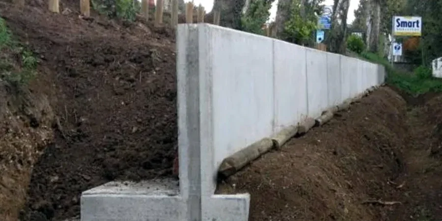
A retaining wall in Napier is only as reliable as the drainage envelope behind it — saturated silt backfill doubles the active thrust overnight.
Local context
Napier sits within a high seismic hazard zone, with the 1931 earthquake serving as a permanent reminder of the tectonic forces at play. The alluvial soils along the Tutaekuri River corridor and the marine silts beneath parts of Ahuriri are susceptible to cyclic softening and lateral spreading during a significant event. A retaining wall that lacks adequate embedment or relies on poor backfill can rotate, tilt, or slide when pore pressures spike during shaking. Liquefaction-induced loss of passive resistance is a real failure mode here, not a textbook footnote. We address this by specifying compacted gravel wedges behind the wall, designing weep holes with graded filter fabrics, and checking the global stability under post-earthquake strength parameters. Ignoring the drainage detail means the wall holds up fine for five years — until a wet winter with a moderate tremor exposes every shortcut taken during construction.
Questions and answers
What is the typical cost range for retaining wall design in Napier?
For a residential or light commercial retaining wall in Napier, the geotechnical design phase typically falls between NZ$1,900 and NZ$8,030. The final figure depends on wall height, proximity to boundaries, ground investigation requirements, and whether the site falls within the liquefaction-prone zones mapped in the Hawke’s Bay regional plan.
How does the 1931 earthquake history influence current wall design in Napier?
The 1931 event raised large areas of the Ahuriri Lagoon and changed the coastline. Modern design uses NZS 1170.5 to define seismic coefficients, and we specifically assess liquefaction triggering in the reclaimed and alluvial deposits. Walls in these zones require deeper embedment, free-draining backfill wedges, and often a global stability check that assumes reduced soil strength during shaking.
Do I need a building consent for a retaining wall in Napier?
Under the Napier City Council District Plan, walls over 1.5 metres in height, or walls supporting a surcharge from a building or vehicle load, generally require building consent. The consent application must include a producer statement from a chartered geotechnical engineer confirming the design assumptions and ground conditions.
What backfill material do you recommend for Napier’s silty soils?
We specify a well-graded gravel or crushed rock backfill with less than 5% fines passing the 0.075 mm sieve, compacted to at least 95% of maximum dry density. This free-draining material prevents the buildup of hydrostatic pressure behind the wall. In areas where local silts must be reused, we design a thicker drainage blanket and additional weep holes to manage the reduced permeability.